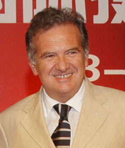
Prof. Fulvio Rinaudo
Confirmed Associate Professor at Politecnico di Torino
Fulvio Rinaudo is PhD, Professor of Geomatics at the Politecnico di Torino (Italy) since 1999.
He contributed to found with Rosa Tamborrino the research group Infrastructuring Cultural Heritage/City History Architectural Network and Geodigital systems in 2013.
Author of more than 200 national and international publications his main research and teaching topics are on digital photogrammetry, LiDAR systems developments and GIS design for Cultural heritage documentation and Land Planning.
From 2012 he chairs the ISPRS WGV/2 “Cultural heritage data acquisition and processing”. President of the Scientific Committee of the Italian Society of Photogrammetry and Surveying he is a member of the executive committees of the Federation of Scientific Associations for Territorial and Environmental Information, ICOMOS/CIPA-HD, Italian Association for Urban History.
RECENT PUBLICATIONS:
2016
Rinaudo, F. (2016), GIS e modellazione 3D: dalla conoscenza al restauro, in: PATRIMONIO CULTURALE: TECNICHE INNOVATIVE PER IL PROGETTO DI CONSERVAZIONE / ROSA ANNA GENOVESE. GIANNINI EDITORE, NAPOLI, pp. 317-328. ISBN 978-88-7431-822-3
Rinaudo, F. (2016), UAV (Unmanned Aerial Veicles). Possibili utilizzi per il monitoraggio dei beni architettonici e paesaggistici. In: PATRIMONIO CULTURALE: TECNICHE INNOVATIVE PER IL PROGETTO DI CONSERVAZIONE / ROSA ANNA GENOVESE. GIANNINI EDITORE, NAPOLI, pp. 365-378. ISBN 978-88-7431-822-3
Tamborrino, R.; Rinaudo, F. (2016), Creative Mapping Landuse and Human Activities: From the Inventories of Factories to the History of the City and Citizens. In: WORLD ACADEMY OF SCIENCE, ENGINEERING AND TECHNOLOGY, vol. 10 n. 11, pp. 3347-3354. - ISSN 2010-376X
Rinaudo, Fulvio, Osello Anna (2016), Cultural Heritage Management Tools: The Role of GIS and BIM. In: 3D Recording, Documentation and Management of Cultural Heritage / Efstratios Stylianidis, Fabio Remondino. WHITTLES PUBLLISHING, Dunbeath, pp. 105-124. ISBN 978-184995-168-5
2015
Tamborrino Rosa; Rinaudo, Fulvio, Linking buildings, archives and museums of the 19th century Turin's Cultural Heritage, in 25th International CIPA Symposium 2015, Taipei, 31 August–4 September 2015.
Tamborrino Rosa; Rinaudo, Fulvio, Sharing knowledge, grasping Cultural Heritage: a digital multidisciplinary approach to the historical process of architecture and urban change, in Le Vie dei Mercanti _ XIII Forum Internazionale di Studi, Aversa, giugno 2015.
2014
Rinaudo F., Mezzino D., GIS and 3D modelling for Cultural Heritage, in Tamborrino R.( a cura di ) Digital Urban History. Telling the history of the city in the age of the ICT revolution, Università di Roma Tre, CROMA, Roma 2014.
F. Chiabrando, F. Rinaudo, Recovering a collapsed medieval fresco by using 3D modeling techniques, in ISPRS Technical Commission V Symposium, Riva del Garda, 23-35 June 2014
2013
Rinaudo F., Devoti C., GIS and Land History: the documentation of the ancient Aosta Dukedom, in XXIV International CIPA Symposium, Strasbourg, 1-6 Settembre 2013.
Rinaudo F., Il Sistema Informativo Spaziale del Parco del Castello Reale di Racconigi: un uovo approccio per la gestione dei beni culturali ed ambientali in Genovese R.A. ( a cura di ) Conoscere, Conservare, Valorizzare, Arte Tipografica Editrice, Napoli.
Bonfanti C., Chiabrando F., Rinaudo F., TLS data for architectural 2D representation and 3D modeling. Different approaches tested in the case of San Giovanni in Saluzzo (Cn) Italy, in XXIV International CIPA Symposium, Strasbourg, 1-6 Settembre 2013.
2012
Spanò A.T., Chiabrando F., Rinaudo F., Contributi della Geomatica ai temi delle ricerche archeologiche di Aquileia, in L'architettura privata ad Aquileia in età romana, Padova, 21-22 Febbraio 2011.
F. Rinaudo, F. Chiabrando, A. Lingua , A.T. Spanò, Archaeological site monitoring: UAV photogrammetry can be an answer, in INTERNATIONAL RCHIVES OF THE PHOTOGRAMMETRY, REMOTE SENSING AND SPATIAL INFORMATION SCIENCES, vol. XXXIX n. B5.
2011
Rinaudo F., Dalla misura al sistema informativo: il ruolo della Geomatica nella documentazione del patrimonio culturale in Genovese R.A.( a cura di) Metodologie e strumenti per la conservazione e il restauro, Arte Tipografica Editrice, Napoli.
Braccio S., Rinaudo F., GIS e gestione del territorio: limiti e prospettive future in Conferenza Nazionale SIFET-Applicazioni Interdisciplinari della geomatica: ricerca,formazione e professione, Portonovo (AN), 22-24 giugno 2011.
2010
Braccio S., Rinaudo F., Open source GIS solutions for access to information of public domain in Free and Open Source Software for Geomatics Conference FOSS4G 2010
Rinaudo F., Spatial Information Systems: a practical tool to share and distribute knowledge about Cultural Heritage, in Ioannides M., Alonzo A., Georgopoulos A., Kalisperis L., Brown A., Pitzalis D.( a cura di) , Heritage in the Digital Era , Multi-Science Publishing Co. Ltd, Brentwood
2009
Rinaudo F., La lettura metrica della cartografia storica: dalla carta al GIS, in Panzeri M.; Farruggia A. ( a cura di ) Fonti, Metafonti e GIS per l'indagine della struttura storica del territorio, CELID, TORINO
Ardissone P; Rinaudo F., WebGIS per la documentazione dei siti archeologici, in BOLLETTINO DELLA SOCIETÀ ITALIANA DI FOTOGRAMMETRIA E TOPOGRAFIA, vol. 2/2009.